
27 May 2015
Wind River Canyon in Wyoming: US20 closed by rockslides and debris flows
Posted by Dave Petley
Wind River Canyon in Wyoming
Unusually heavy rainfall in Wyoming on Sunday triggered a series of landslides that has led to the closure, probably until Wednesday, of the US20 highway between Thermopolis and Shoshoni as well as the BNSF railway line.
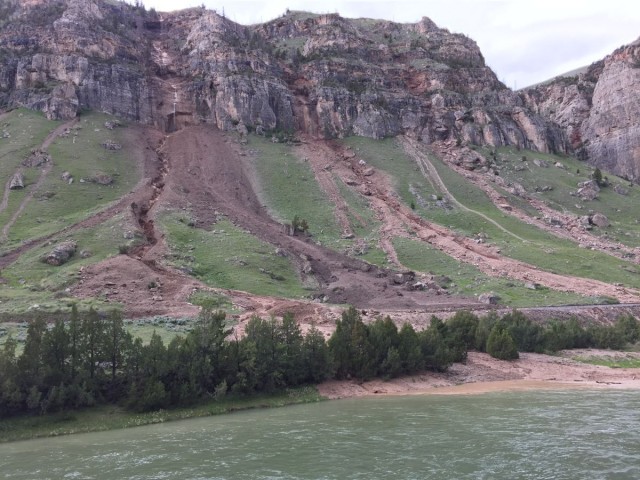
The best coverage of the event is on the County 10 website, which has a splendid gallery of images of the landslides. This image for example is both beautiful and technically interesting:
.
These are not simple landslides by any means. In all three cases they involves water that has been channelised on the steep slopes, from where it has collected debris, and which has triggered the detachment of boulders from the bluffs. The flows have transitioned into true debris flows on the fan below the bluffs. Note that in most cases the flows have eroded sediment from the fan in the steeper portion, adding to their volume. At the point at which the gradient of the slope reduces, just above the railway line, the flows have stopped eroding and have started to deposit, with the larger boulders being left higher on the slope and finer material further down. This is classic debris flow behaviour.
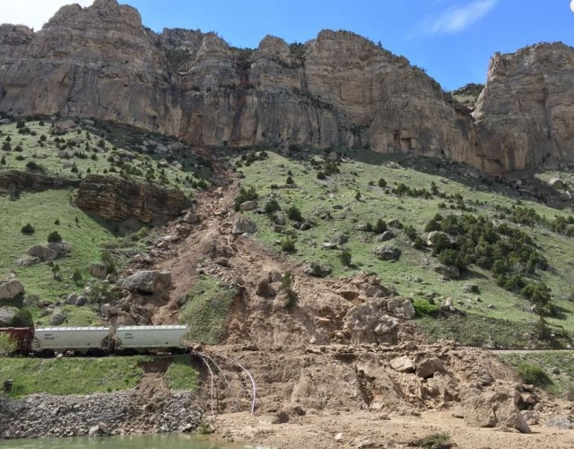
Other failures show slightly different behaviour. This one for example appears to have been erosive all the way to the river, probably because these was no reduction in slope gradient all the way down to the floor of Wind River Canyon:-
.
Google Earth gives a better understanding of the nature of these landslides. In fact above the bluffs each of these gulleys has quite a large catchment of more erodible material:
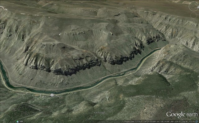
Wind River Canyon from Google Earth
.
These upper catchments are likely to be the source of much of the sediment that forms the debris fans at the slope toe and that comprises the solid part of the debris flows.
 Dave Petley is the Vice-Chancellor of the University of Hull in the United Kingdom. His blog provides commentary and analysis of landslide events occurring worldwide, including the landslides themselves, latest research, and conferences and meetings.