On 3 March, 2021, an earthquake of magnitude MW6.3 hit northern Thessaly in Greece. According to the USGS, the hypocentre was at 11.5 km depth. Normal faulting occurred either on a plane dipping 55° to the SW or on a plane dipping 36° to the NE. The quake caused a lot of damage in the village of Tyrnavos (Τύρναβος) and the surrounding areas. Widespread liquefaction was also observed. On 4 March, 2021, a mb5.8 aftershock occurred. Our colleagues S. Pavlides, A. Chatzipetros, S. Sboras, E. Kremastas and A. Chatziioannou have prepared a first field report in which they document the environmental effects of the quake.
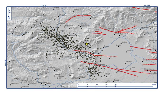
The quake apparently ruptured a previously unknown fault in the vicinity of the well-known Tyrnavos and Titarisios Valley faults.
Download the field report here (PDF, 1.5 mb):

By loading the video, you agree to YouTube’s privacy policy.
Learn more
Also check out Sotiris Valkaniotis’ InSAR maps from the earthquake and its aftershocks.


» Presentation on the March 2021 earthquakes in Thessaly, Greece by A. Ganas et al. | 2021-03-20|22:14 (UTC)
[…] Also, check out the field report by S. Pavlides and colleagues here. […]