
20 February 2018
First satellite images of the Puerto Venus debris flows
Posted by Dave Petley
First satellite images of the Puerto Venus debris flows
Yesterday I highlighted the Puerto Venus debris flows that struck a rural community in Colombia last week, destroying a number of houses. Whilst loss of life was avoided, the events caused significant damage. They were also caught on some remarkable videos, which I included in my post. There was speculation yesterday that the landslides had been caused by a the breach of a valley blocking landslide upstream near to El Pinal, but of course this can only be confirmed via satellite imagery or by fieldwork. I have taken a look at the Planet Labs images of the area affected by the debris flows. Whilst we are still waiting for a cloud-free image (challenging in this area at this time of year), these are quite informative. The image below, collected by Planet Labs (and used with permission) with a 3 m resolution before the debris flows, shows the catchment above Puerto Venus, from which the debris flows originated:-
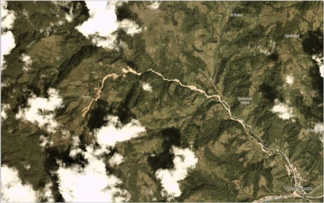
The catchment at El Pinal, from which the Puerto Venus debris flows originated. Planet Labs image collected on 21st January 2018. Used with permission of Planet Labs.
.
The image below, of the same area, was collected yesterday (19th February 2018), also by Planet Labs:-
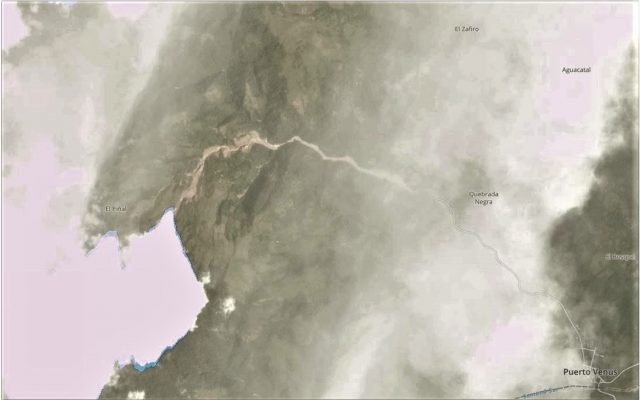
Planet Labs image showing the catchment below El Pinal in Colombia in the aftermath of the Puerto Venus debris flows. Image collected 19th February 2018, used with permission.
.
Whilst the image yesterday is affected by cloud and haze, the image shows that the debris flows originated high up in the catchment, upstream of the two landslides that were triggered late in 2017. Unfortunately the source is in cloud, but the dramatic scour downstream is evident. It seems likely that there is extensive slope collapse. A closer look at this area shows the amount of material that has been removed from the channel:-
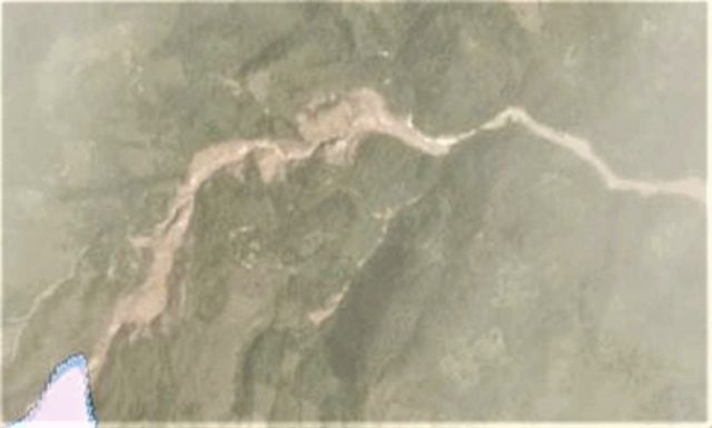
Planet Labs image of the track of the Puerto Venus debris flows. Used with permission.
.
Hopefully a cloud-free image will become available in the next few days.
Reference
Planet Team (2017). Planet Application Program Interface: In Space for Life on Earth. San Francisco, CA. https://api.planet.com
 Dave Petley is the Vice-Chancellor of the University of Hull in the United Kingdom. His blog provides commentary and analysis of landslide events occurring worldwide, including the landslides themselves, latest research, and conferences and meetings.