New from Snet: Lithologs, a new tool to create lithological/sedimentological logs online..
Posts treating: "Markagunt Plateau"
Sunday, 12 October 2014
Hiking Along the Headwaters of the Virgin River
WATCH FOR ROCKS - Travels of a Sharp-Eyed Geologist [2014-10-12 07:20:18]
 recommend this post
(120 visits)
recommend this post
(120 visits) 
Neogene,Paleogene; CI,US
recommend this post
(120 visits) 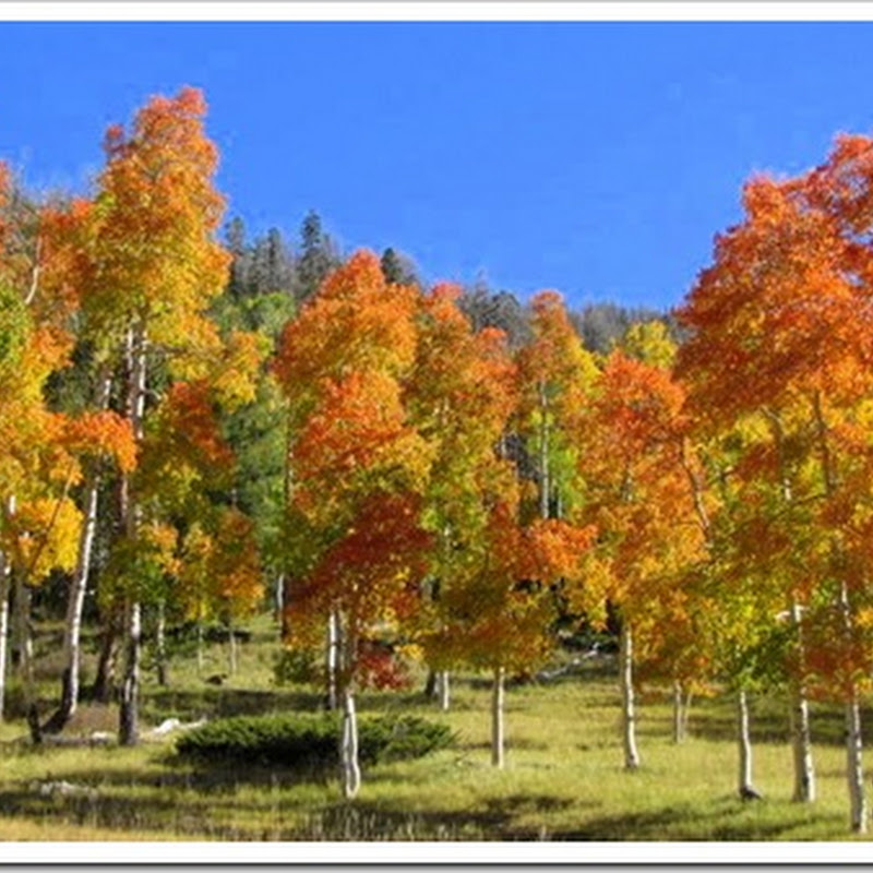
Geologic Map of the Haycock Mountain Quadrangle, Garfield County, Utah
By: Robert F. Biek, John J. Anderson, Edward G. Sable, and Peter D. Rowley The Haycock Mountain quadrangle lies in the central part of the Markagunt Plateau in southwest Utah and includes the eastern part of Panguitch Lake, a popular area of summer and winter recreational use. Despite the plateau’s relatively simple structure of aGeologic Map of the Panguitch Lake Quadrangle, Garfield and Iron Counties
By: Robert F. Biek, John J. Anderson, Edward G. Sable, and Peter D. Rowley The Panguitch Lake quadrangle lies in the central part of the Markagunt Plateau in southwest Utah and includes Panguitch Lake, a popular area of summer and winter recreational use. Despite the plateau’s relatively simple structure of a gently east-tilted fault block,POTD April 25, 2014: Dixie National Forest, Iron County, Utah
Have a great weekend everyone! Dixie National Forest, Iron County, Utah Photographer: Robert F. Biek; © 2012 Hancock Peak (elevation 10,598 feet) is one of many cinder cones that dot the Markagunt Plateau east of Cedar City. Engelmann spruce trees, many of which were killed by spruce bark beetles, and colorful quaking aspen blanket theGeologic Map of The Brian Head Quadrangle, Iron County, Utah
By: Peter D. Rowley, Robert F. Biek, Edward G. Sable, Jonathan T. Boswell, Garrett S. Vice, Stanley C. Hatfield, David J. Maxwell, and John J. Anderson The Brian Head Quadrangle straddles the west edge of the Markagunt Plateau and is roughly centered on Brian Head Peak, at 11,307 feet (3446 m) the highest mountain inPOTD July 16, 2013: Dixie National Forest, Kane County, Utah
Dixie National Forest, Kane County, Utah Photographer: Tyler Knudsen Golden aspen, blue sky, and dark basaltic lava provide dramatic contrast along the Navajo Lake Loop Trail on the Markagunt Plateau. The geologically young Quaternaryage lava erupted from a nearby cinder cone and flowed across Duck Creek, creating a natural dam that formed NavajoTop concepts:
Top posts:
- NOAA plot confirms continued global warming (86 visits)
- Sharp talon of cold coming to jab us (84 visits)
- Bolsilibros Mesozoicos (V): La conquista del espacio (78 visits)
- Further earthquake reading: Philip Fradkin (78 visits)
- Il film più politicamente corretto della storia (73 visits)
- Spring Clipper comes down on Toronto (69 visits)
- Regulating Air Toxics from Petrochemical Plants (67 visits)
- Greenhouse effect (59 visits)
- South Dakota Maples—Sugar, Silver, & a Trickster (58 visits)
- TURTLE SHELLS: HOME SWEET ARMOUR (58 visits)
Ads: